

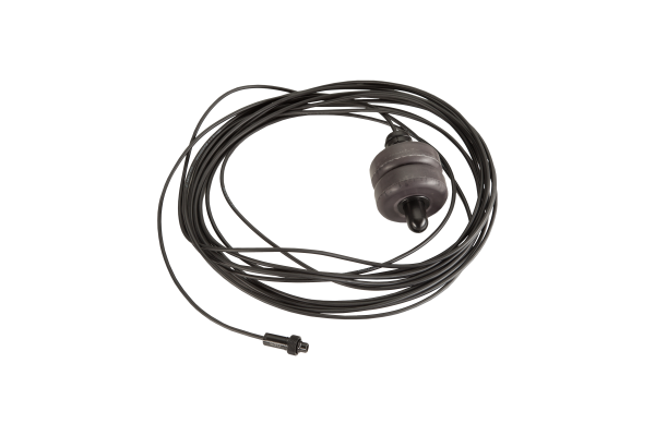


GPS set with buoy - type B (included 10m connecting cable)
GPS position underwater Underwater, there is no GPS signal reception possible – because all is absorbed by water. This makes underwater navigation much more complicated than typical car navigation and requires devices such as regular ENC3 which use dead-reckoning position calculation.
When the float is used and sent to the surface, the divers’ real position is recalibrated, in order to compensate for possible drift from sea currents and have the real position updated.
Thanks to the version with a buoy and a 3 or 10m cable, GPS position can be obtained without a need to surface.
Modular construction GPS TYPE B The Electronic Navigation Console ENC3-PRO allows connecting a dedicated external miniature GPS receiver, which can be quickly connected in several ways to the console.
In the version with a short cable and a GPS module mounted directly on the ENC, recalibration can be made each time the diver surfaces, making it ideal for shallow dives, or other tasks.
How does it work? Underwater, any pre-set target can be chosen, at any moment to navigate to this specific point.
The ENC3-PRO calculates the diver’s position underwater using the same method as the ENC3. When there is no GPS position available, it will use calculated dead-reckoning underwater data as a position source.
When the GPS signal is acquired with sufficient reliability, this position is re-calibrated as the so-called FIX position, and the ENC3-PRO will start further position calculation from this point on.
The diver may follow the pre-planned points one-by-one, or decide (based on the situation) where he wants to navigate.
Route planning and track visualisation Up to 29 route points can be easily programmed using the freeware PC software. Points positions can be chosen directly on the map, saved as GPS coordinates, or as azimuth/distance.
Each point can have a short text description that will be displayed on the ENC underwater. During the dive, any pre-set target can be chosen, at any moment to navigate to this specific point.
After diving, logged tracks may be accessed and reviewed. Multiple export options are available, facilitating processing the tracks for example in Google Earth, GIS programs, or even accessing the raw data as .csv (Excel) format.
All obtained GPS positions are stored in ENC3-PRO memory, allowing detailed archeological or scientific survey.
MULTIPLE OPTIONS The miniature GPS type B module receiver provides a lot of installation options and allows for quick and precise position measurements .
The same module may be directly connected to the ENC3-PRO with a 0,1m cable or used with a 3 m, or 10 m long cable and additional buoyancy floats. Changing the cable is very simple and requires no tools .
3 and 10m cables can be easily winded on the dedicated winding holders attached to the DPV.
In the attached picture, you can see FUTURE 1000 with the assembled ENC3-PRO with GPS module float and winded-up 3m cable on winding holders on the scooter.
- Manufacturer
- Seacraft
- Catalog number
- E1140